Start slowly, with one place. Find a view and a small meal.
千代田町
Local historyFirst-visit planCheck transport
Hi, I’m Tabi!
This Chiyoda is a town in Gunma’s Ora district with river transport and parks, distinct from Tokyo’s Chiyoda ward. Choose the ferry or park first after checking river weather and current access.
This guide covers places within Chiyoda, rather than places immediately beside your app check-in.
01 · EXPLORE
Two places to begin
Two different places: start with whichever interests you.
01
A first-visit stop
Akaiwa Ferry
赤岩渡船
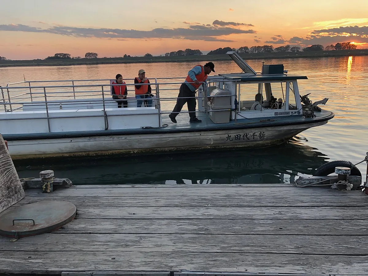
A ferry connecting Chiyoda’s Akaiwa with Kuzuwada in Kumagaya, Saitama, across the Tone River. The photograph shows Shin-Chiyodamaru in 2019. This guide focuses on the Gunma approach; strong winds or high water can suspend service. The opposite bank is a different municipality.
Getting there Check current timetables and return services on the Tatebayashi–Chiyoda bus route from Tatebayashi Station to Akaiwa Ferry; do not cross when suspended.
A park themed around Tone River water and wind, with greenery, play and sport spaces. Check current arrangements and reservations for the outlook, slides and sports facilities. A riverside park is not unrestricted swimming space; follow children’s use rules.
Getting there Locate the park entrance in Maigi on its official map and plan transport separately from the ferry.
The town’s official food-culture material discusses rice, barley and vegetable production and examples of eateries using Chiyoda-grown rice. Check actual origin and availability when choosing meals or produce. This neither guarantees local rice at every eatery nor recommends a specific shop.
Resized, metadata removed and converted to WebP; display crops vary by screen. Adapted CC BY-SA photos retain the original license.
Photos are historical material dated in the credits, not a guarantee of present scenery or operation. Places without photos use decorative name panels.


 01
01
